

Wondering, Wandering, Colorado to Utah
- Robert G. Nulph

- Jun 1, 2021
- 5 min read
After my day exploring Adam's Falls I decided to take it easy the next day (Thursday) and relax in Granby with a short foray into Winter Park for lunch.
The mountains of the Front Range are quite impressive and beautiful. Great eye candy on the way to and from Winter Park.


Friday I continued my journey, leaving my Casita in Granby and heading south to Pagosa Springs. On the way I passed through a massive amount of mining both new and old as well as some beautiful mountain vistas.
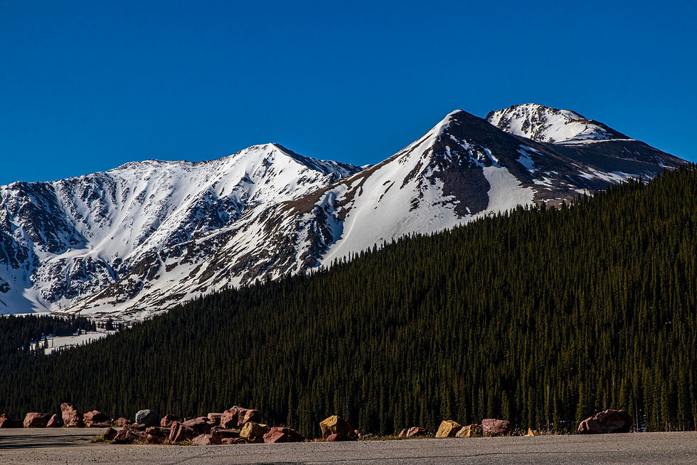
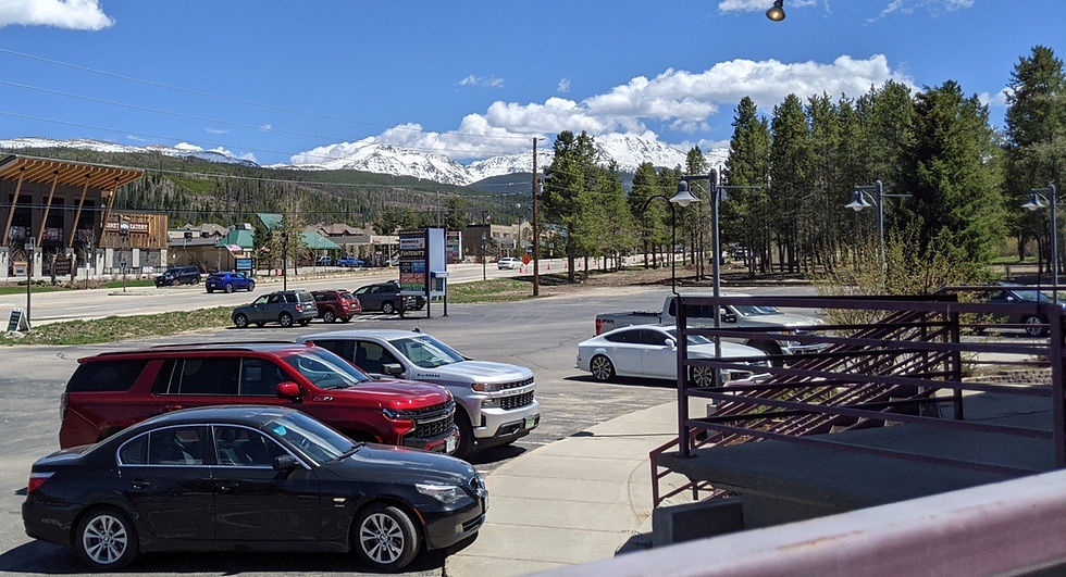
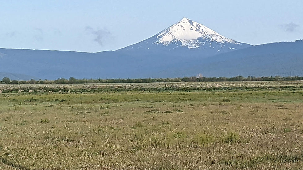
My first stop, Leadville, Colorado. This quaint little community has the honor of being the highest incorporated city in the US at 10,152 feet above sea level. From its main street and surrounding environs, you can see many of Colorado's 14,000 foot peaks. The most notable being Mt. Elbert at 14,440 feet - the highest point in Colorado. And of course I had to get a really good breakfast at the Silver Llama!


After purchasing my requisite magnet and a very nice but low-priced Leadville Fleece, I headed out of town and was instantly forced to stop to take some shots of the beautiful Mt Elbert and its Massive neighbor appropriately named Mt. Massive!. This is also the headwaters of the Arkansas River.
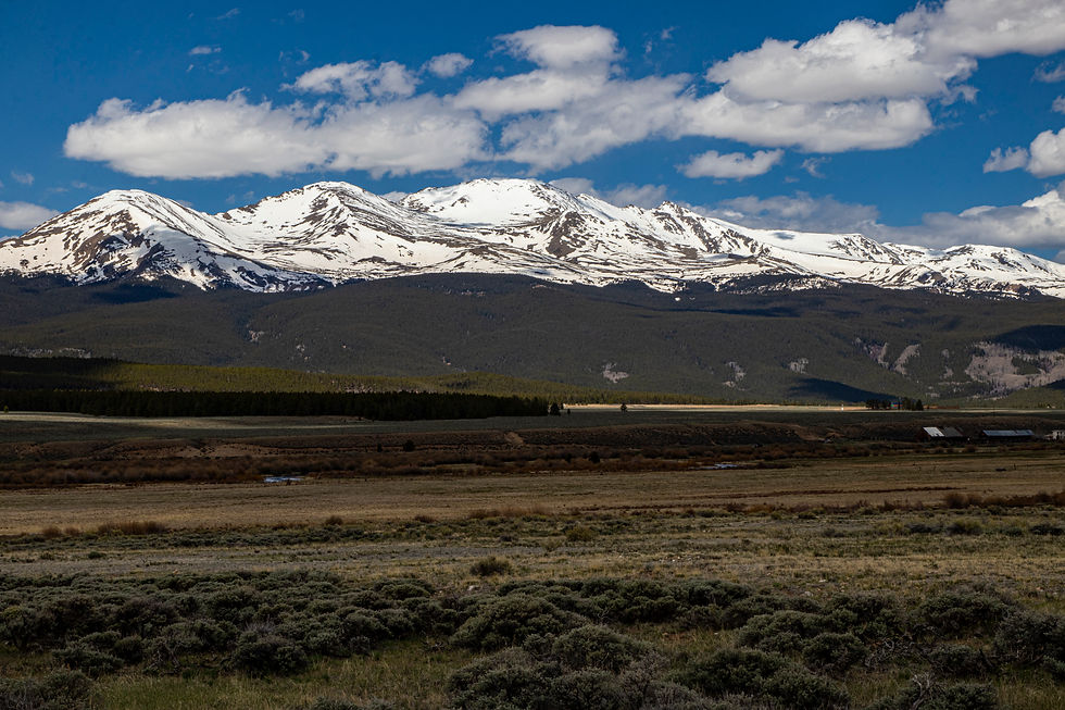


As you drive south on US 24, looking to the west, you pass some more 14'rs - part of the Collegiate Peaks – part of the Sawatch Mountain Range. The tallest is Mt Harvard at 14,421 feet.

And of course where there is Harvard, there has to be Yale!

More of Harvard and other collegiate peaks.


As I journeyed further south, I hit route 285 and soon began to see the beautiful Sangre de Cristo Mountains to the east and nestled in their shadow - Great Sand Dunes National Park. Although I had been there twice before, I decided to stop for a visit. Of course, being the beginning to Memorial day Weekend, it had a lot of visitors. It was pretty warm so the walk through the creek to get to the dunes was very refreshing. There were a lot of people trying to snowboard down the dunes but I saw very few that were very successful. I you look at the image at the beginning of the third row, there is a row of people at the very top of the dunes. I think they were having some kind of competition down the other slope. And no I did not check it out. I got about a third of the way up and had to stop. Sand is very hard to climb!


My next stop... Zapata Falls. To get there you have to drive a very rough gravel, rock, dirt road that grinds its way up to a campground and the trail to the falls. The last part of the "trail" is the creekbed.

However, after picking your way about a quarter to half mile up the creek, you duck under a ledge in a narrow opening and around the corner is the falls along with a shelf of blue ice which never seems to melt!


The falls is a hidden 25 ft. blast of water that almost immediately covers your lens with spray. To get the complete falls with my camera, I would have had an ultrawide lens because you have to almost get right up to the falls to see it as it is around a bend in the rock canyon. Enjoy the video!
Finally, after weaving my way (and at times going arrow straight for miles on some back country farm roads) I made it to Highway 160 and up and over Wolf creek Pass to Pagosa Springs, Colorado - my next resting spot. My condo there had amazing views and it was a very comfortable stay.


After a great meal at the Colorado Roadhouse, I settled in for the night, wondering about a lot that I had seen so far in my wandering. Some of the questions I was wondering about were: why in the front range mountains around Granby and Rocky Mountain National Park are there so many downed trees. The forest floor is literally littered with fallen trees from blow downs, past fires and insect death. The 2nd question was: are the reservoirs always this low this time of year. Granby Lake was extremely low and Green Mountain Reservoir was practically empty except in the very deep sections. Do they fill up with snowcap runoff? And will they come up to their original level? What about all of the people who have built on their edges. Not a great sight!
Saturday morning I hit the road north to Crested Butte, Colorado. This is a very nice town nestled in the shadow of its namesake. While there, I enjoyed a delicious bacon, pepperoni, spinach and mushroom pizza at Brick Oven Pizzeria.


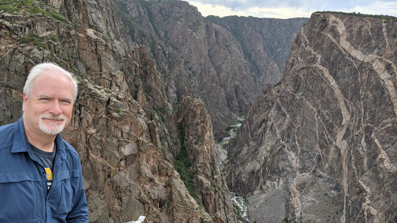
With a very full and satisfied tummy, I headed to Black Canyon of the Gunnison National Park. This is a little known National Park just north of Montrose, Colorado. It has amazingly steep canyon walls that the Gunnison river has carved through the years. It also is known for its distinctive whitish pink stripes created by imbedded layers of pegmatite with some crystals measuring over six feet in length. The canyon is called Black Canyon because the walls are often shrouded in shadow because they are so steep and the canyon narrow. The canyon also has some of the oldest exposed rock on earth!


While at the canyon, I kept hearing this clicking. As you can see, the locust had arrived in force!
When I finally hit the road from this awe inspiring national park, I began to weave my way back to Pagosa. The road back - Highway 550, Winds through the San Juan Mountains and the towns of Ridgeway, Ouray and Silverton until you finally land in Durango at the base of the San Juans. This road is extremely windy with a lot of 15mph switchbacks with no guardrails. While weaving my way south I had the joy of listening to a Jimmy Buffet concert recorded earlier this year in Delray, Florida. Fun and soothing music to calm the nerves as I rode the mountain highways up and down - a drive that is both beautiful for its vistas and beautiful scenery and deadly due to the narrow roads and hundreds of feet dropping off the edge of the road. Not a road to speed or let your attention stray!
Sunday morning, I hit the road early to begin my journey to St. George, Utah where I will spend the next two weeks. On the way I stopped at Monument Valley hoping to get on the valley floor and visit where John wayne and John Ford shot so many of their movies. The Navajo park was closed including the valley. So after getting a few shots of John Wayne's cabin from Tie a Yellow Ribbon and a few of the monuments in sight. I hit the road west.


On the way to St. George, I passed through Page, Arizona. There I found that Antelope Canyon is also closed until further notice due to Covid.
Now I am in St. George and taking time to relax, see a movie and catch up on this blog. I hope you enjoy the photos. Tomorrow I am heading to the North Rim of the Grand Canyon. Stay Tuned!


Comments